DESCRIPTION
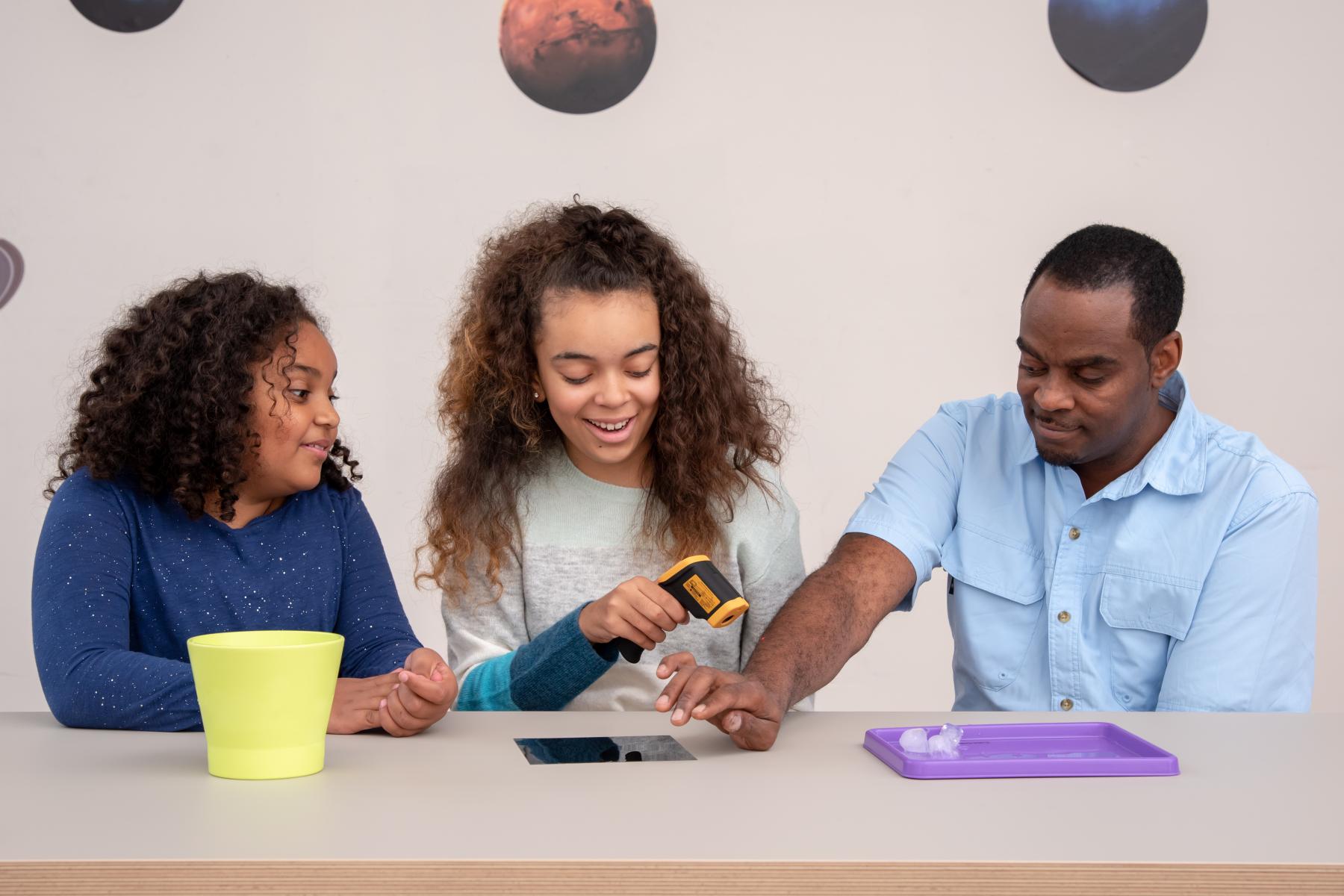
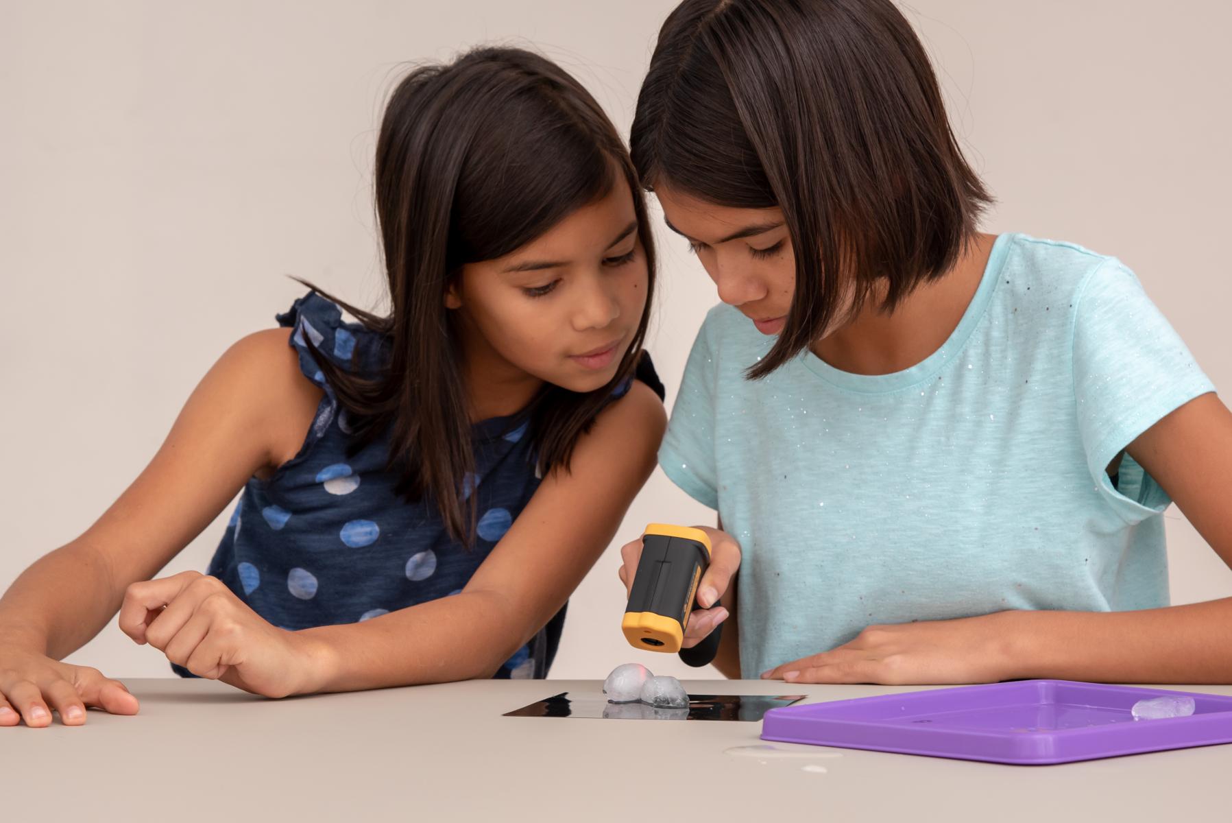
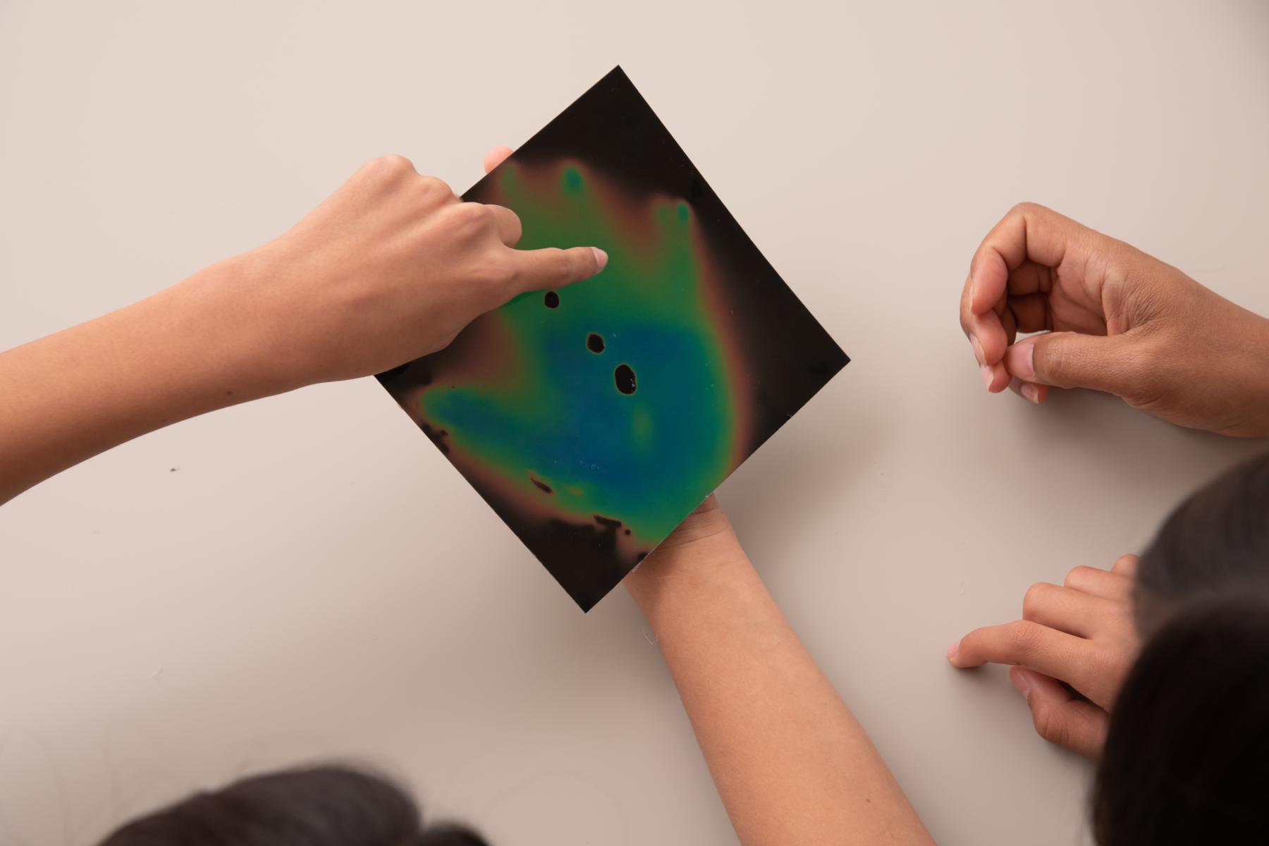
This activity models the way Landsat satellites use a thermal infrared sensor to measure land surface temperatures. IR technology, like the IR thermometer in this activity, uses the infrared light emitted by an object to measure its temperature remotely (without having to touch it!) By taking a series of measurements over an area, a scientist can create a visual representation of the surface temperatures (like a weather map for surface temperatures rather than air temperatures.)
DESCRIPTION
This activity models the way Landsat satellites use a thermal infrared sensor to measure land surface temperatures. IR technology, like the IR thermometer in this activity, uses the infrared light emitted by an object to measure its temperature remotely (without having to touch it!) By taking a series of measurements over an area, a scientist can create a visual representation of the surface temperatures (like a weather map for surface temperatures rather than air temperatures.)
TRAINING VIDEOS
OBJECTIVES
BIG IDEA
Earth is a constantly changing and dynamic system.
LEARNING GOALS
- Different types of land cover on Earth absorb or reflect energy from the Sun in different ways.
- NASA scientists study land cover to understand and predict how Earth's climate is changing.
DOWNLOAD FILES
- Exploring Earth: Temperature Mapping facilitator guide (PDF)
- Exploring Earth: Temperature Mapping activity guide (PDF)
- Urban Heat Islands information sheet (PDF)
- Exploring Earth: Temperature Mapping table sign (PDF)
- Exploring Earth: Temperature Mapping activity guide (Spanish) (PDF)
- Exploring Earth: Temperature Mapping table sign (Spanish) (PDF)
- Urban Heat Islands information sheet (Spanish) (PDF)
BROWSE RELATED RESOURCES
Credits
Arizona State University
This material is based on work supported by NASA under cooperative agreement award numbers NNX16AC67A and 80NSSC18M0061. Any opinions, findings, and conclusions or recommendations expressed in this material are those of the author(s) and do not necessarily reflect the view of the National Aeronautics and Space Administration (NASA).
Creative Commons Attribution Non-Commercial Share Alike 3.0 United States (CC BY-NC-SA 3.0 US).
View more details
![]()
NISE Network products are developed through an iterative collaborative process that includes scientific review, peer review, and visitor evaluation in accordance with an inclusive audiences approach. Products are designed to be easily edited and adapted for different audiences under a Creative Commons Attribution Non-Commercial Share Alike license. To learn more, visit our Development Process page.